The same tree gives a different answer in April and July.
FloraPlot works out the real sun, soil and climate for your exact garden — your fence, your greenhouse, your neighbour's tree — then matches plants to what you actually have. Not what a map thinks you have.
Download on the App StoreiOS · Free to download · One-time purchase for Premium, no subscription
One real garden
From satellite trace to planting decision
A garden with a shed, a mature tree, and a mix of open lawn and border. Same plot, two months, genuinely different answers.


The whole sequence
Not a shadow tool. Not a plant app. The chain between them.
Shadow tools do a one-off lookup. Plant apps know nothing about your specific site. Nothing else runs the full sequence from measurement to ongoing care.
Shade — modelled from what's actually there
Your structures at their real heights, greenhouses that transmit light rather than block it, trees with canopy density that thins out in winter. Sun hours per month, on a grid across the whole garden.
Soil — pH, carbon and texture for your coordinates
No meter required. Sand, silt and clay percentages classified in plain language, so you know what you're actually planting into.
Climate — local normals, not generic advice
Historical climate data and hardiness for your exact location, not a regional guess.
Plants — matched against measured conditions
A curated database checked against your zone's actual sun, soil and space — not a generic "shade-tolerant" list.
Safety — filtered by your household
Toxicity flagged by route — eaten or touched — and filtered for pets, small children, or neither. Edible crops aren't flagged as poisonous just because a part of the plant is.
Tracking — what happens after you plant
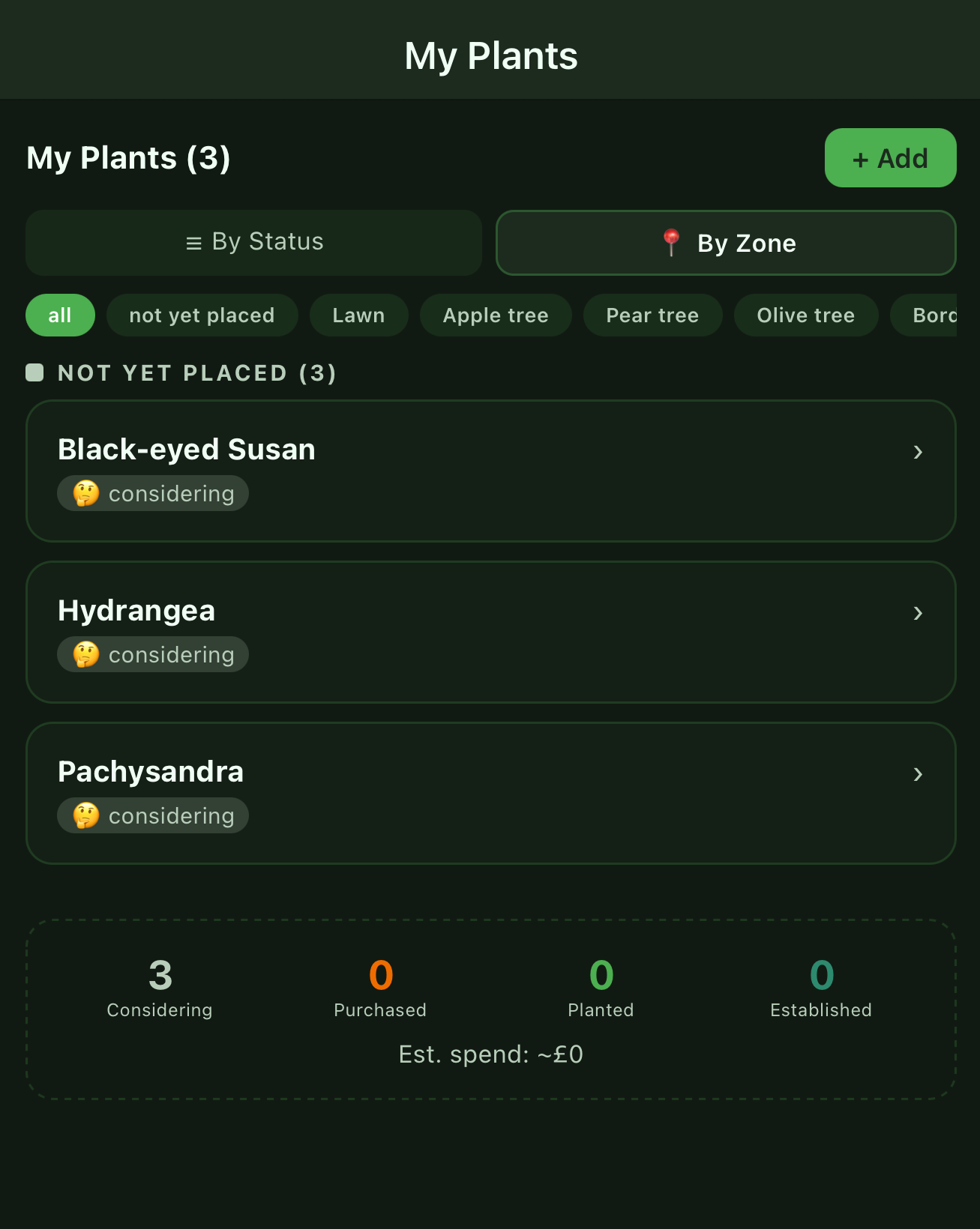
What's considered, purchased, planted, established. Care reminders written to your iOS Reminders app, not another notification system to manage.
What map-based tools structurally can't do
Your garden isn't on the map.


New in v1.8
Will this spot still be sunny in ten years?
Trees don't stop growing. A young tree that barely touches a border today can shade it out within a decade — and a spot that looks perfect for a sun-loving plant right now might not stay that way. FloraPlot can show the shade your garden will cast once its trees reach full size, without changing anything about how your garden looks today.


New in v1.9
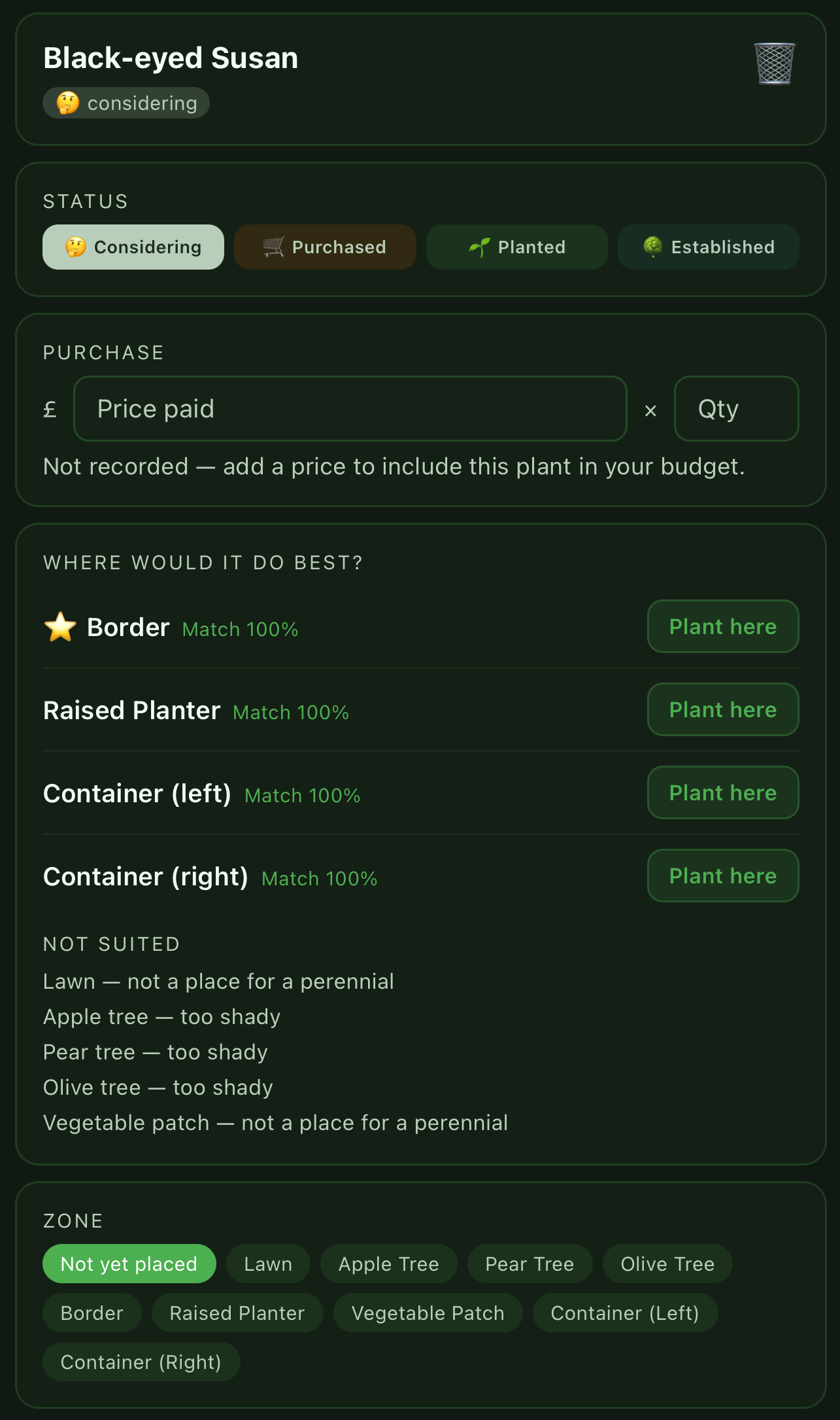
Tell it about a plant. It'll tell you where.
Add anything to My Plants and FloraPlot ranks the spots in your garden most likely to suit it — using your soil, your aspect, and the shade your own structures and trees actually cast. It also says which spots it ruled out, and why, so the ranking is something you can check rather than just trust.
Privacy
No account. Your garden never leaves your phone.
No sign-up, ever
No accounts, no login, no user data stored on any server.
Location, used once
Your coordinates fetch soil and climate data — they're never stored remotely.
Apple handles payment
The developer never sees your card details. Standard App Store purchase.
No ads, no tracking
Nothing to sell, no data broker, no analytics following you around.
We'd rather tell you than have you find out
Only structures you draw cast shade — a neighbour's house won't affect the model unless you add it. Ground is assumed flat, with slope applied as a correction. Soil is modelled at 250m resolution. These are real limits, not hidden ones.
Read how the sun model actually works →Know before you plant.
Free to download. Upgrade to Premium for £3.99 — once, not monthly.
Download on the App Store